md4-3000

Robust, Powerful, Stable and Dependable.

The largest Microdrones aircraft that can carry more, fly longer, and reach higher. It can handle heavy LiDAR sensors, professional mapping grade cameras, multiple sensors, and more. If you’re looking for a UAV that allows you to go above and beyond, md4-3000 is the strongest choice in the industry.

KEY ADVANTAGES

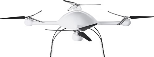
Flight time up to 45 mins

Withstands environmental challenges such as wind, rain and snow etc.

Payload capacity up to 5 kg

Georeferencing in challenging locations is available

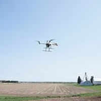
Covers more ground in less time

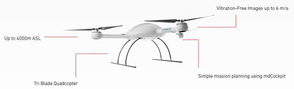
Fly to heights up to 4000 m

APPLICATION AREAS

Mining
Construction
Area Mapping/Land Surveying
Inspection
Precision Agriculture

DESKTOP SOFTWARE

mdCockpit brings together the three main functions you’ll need to implement missions:​

Flight planning
Set up automatic missions in minutes with mdCockpit’s Waypoint Editor which integrates with Google Earth to make the process extra simple.


Flight monitoring
Watch your flights as they happen on your tablet or computer. Receive real-time telemetric data through mdCockpit’s Downlink Decoder. Alerts, status updates, and flight information is spoken to you in one of 30 languages as you monitor your flight.


Flight analytics
Record and analyze the data you collect with mdCockpit’s Analytics Module This allows you to keep detailed flight logs so you’ll have the info you need to improve future missions.

TECHNICAL SPECIFICATIONS

Rate of climb

10 m/s

Weight: ca.

6 Kg

Maximum load

5 kg

Maximum take-off weight (MTOW)

16Kg

Flight time

up to 45 minutes

Battery

10S1P LiPo, 37.0 V, 21000mAh

Temperature

-10 °C up to 50 °C

Humidity

max 90% r.H.

Service ceiling

2000 m ASL, 4500 m ASL - 3-blade carbon rotors necessary

Take-off altitude

up to 4000 m NN (WGS84)

Disclaimer: information provided may change without notice, please contact our sales for assistance in procurement, etc.