AVES II

Survey Mapping Drone

AVES ll is best suited for operations where high-quality mapping and surveying is of utmost importance.With a modular design and payload capacity of 1.5kg, possibilities are endless.

KEY ADVANTAGES

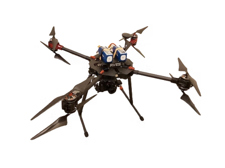
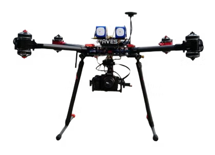
Flight time up to 25 mins

High resolution SLR camera up to 42 megapixel

Payload capacity up to 1.5kg

Real Time Kinematics .For Mapping Applications

Modular Design

APPLICATION AREAS

Area Mapping/Land Surveying
Aerial Photography
Inspection/Monitoring

TECHNICAL SPECIFICATIONS

Maximum Weight

7 Kg

Maximum Payload

1.9 Kg

Maximum Flight Time

25 Minutes

Operating Temperature

-9° to 42° C

Motor kV

340kV

Propeller Diameter

22 Inches

Survey Camera

Sony A7 R2

Gimbal

2 Axis Servo Gimbal

Flight Controller

Pixhawk 32 Bit Autopilot

Maximum Wind Endurance

22m/s

Disclaimer: information provided may change without notice, please contact our sales for assistance in procurement, etc.